Lincoln City boundary
Introduction
The photograph on this page of Lincoln City boundary by Jo and Steve Turner as part of the Geograph project.
The Geograph project started in 2005 with the aim of publishing, organising and preserving representative images for every square kilometre of Great Britain, Ireland and the Isle of Man.

There are currently over 7.5m images from over 14,400 individuals and you can help contribute to the project by visiting https://www.geograph.org.uk
Lincoln City boundary
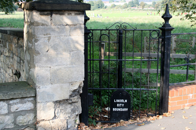
Image: © Jo and Steve Turner Taken: 21 Sep 2008
The 'Parliamentary Borough Boundary' running down the B1190 and then turning here between the Cow Paddle and Old Cemetery is shown on the OS maps up to 1950. It appears to have been defined along with the Canwick Enclosure award in 1787 and was in place until 1967 when it was revised to its current position along the B1190 Washingborough Road to encompass the sewage works. The Crematorium was built in 1968 but I don't know if this had any influence on the boundary change.
Images are licensed for reuse under creativecommons.org/licenses/by-sa/2.0
Image Location
Latitude
53.218781
Longitude
-0.52714