Brampton
Introduction
The photograph on this page of Brampton by Ian Capper as part of the Geograph project.
The Geograph project started in 2005 with the aim of publishing, organising and preserving representative images for every square kilometre of Great Britain, Ireland and the Isle of Man.

There are currently over 7.5m images from over 14,400 individuals and you can help contribute to the project by visiting https://www.geograph.org.uk
Brampton
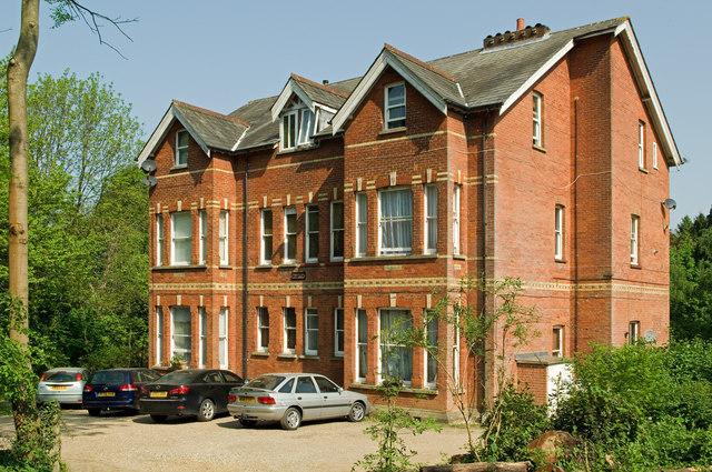
Image: © Ian Capper Taken: 25 Apr 2011
This large Victorian house, now divided into flats, first appears on the 1896-97 map, as one of four unnamed buildings next to each other on Nutfield Road. By the time of the 1935-38 map, only the central two were still there, this building and the one immediately to the east, with both the easternmost and westernmost of the quartet no longer shown. The names Brampton and Rosenhalles (its eastern neighbour, similar in design) first appear on the 1966-68 map.
Images are licensed for reuse under creativecommons.org/licenses/by-sa/2.0
Image Location
Latitude
51.236359
Longitude
-0.1573