Sgwt Garnswllt / Garnswllt waterfall
Introduction
The photograph on this page of Sgwt Garnswllt / Garnswllt waterfall by Alan Richards as part of the Geograph project.
The Geograph project started in 2005 with the aim of publishing, organising and preserving representative images for every square kilometre of Great Britain, Ireland and the Isle of Man.

There are currently over 7.5m images from over 14,400 individuals and you can help contribute to the project by visiting https://www.geograph.org.uk
Sgwt Garnswllt / Garnswllt waterfall
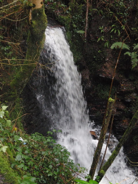
Image: © Alan Richards Taken: 1 Jan 2012
Gelwir y llecyn hwn yng Ngarnswllt 'Y Sgwt' am resymau amlwg. Enw'r ffrwd yw 'Garnant' (< Garwnant) ac fe'i rhed o dan yr heol fach sy'n arwain o Garnswllt at Bontardulais. The name of this location in Garnswllt for obvious reasons is 'Y Sgwt' (trans 'The Waterfall'). The name of the stream is Garnant < Garwnant (trans. Wild stream) and it flows beneath a minor road which leads from Garnswllt to Pontardulais.
Images are licensed for reuse under creativecommons.org/licenses/by-sa/2.0
Image Location
Latitude
51.757805
Longitude
-3.999107