The Shore Circular Path (damaged)
Introduction
The photograph on this page of The Shore Circular Path (damaged) by Lairich Rig as part of the Geograph project.
The Geograph project started in 2005 with the aim of publishing, organising and preserving representative images for every square kilometre of Great Britain, Ireland and the Isle of Man.

There are currently over 7.5m images from over 14,400 individuals and you can help contribute to the project by visiting https://www.geograph.org.uk
The Shore Circular Path (damaged)
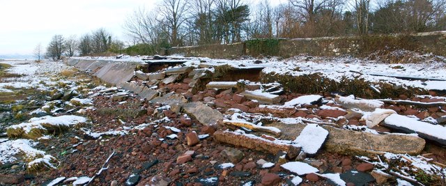
Image: © Lairich Rig Taken: 16 Dec 2011
At the top of the embankment is one of the area's core paths; the section shown here is about 90 metres further along the route that is shown in Image Winds of up to 80 mph have driven the waters of the River Clyde against the embankment, destroying this part of it, and undermining the path's tarmac. Before the storm, many days of heavy rain had already caused flooding in other parts of the town. For a later view of this part of the route, see Image For damage elsewhere on the same path, see Image
Images are licensed for reuse under creativecommons.org/licenses/by-sa/2.0
Image Location
Latitude
55.93953
Longitude
-4.585186