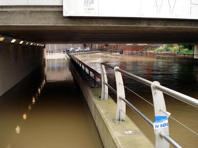
Flooding under Wigford Way
Introduction
The photograph on this page of Flooding under Wigford Way by Jo and Steve Turner as part of the Geograph project.
The Geograph project started in 2005 with the aim of publishing, organising and preserving representative images for every square kilometre of Great Britain, Ireland and the Isle of Man.
There are currently over 7.5m images from over 14,400 individuals and you can help contribute to the project by visiting https://www.geograph.org.uk

Image: © Jo and Steve Turner Taken: 26 Jun 2007
At least from 1888 up to the building of Wigford Way in the early 1970s the road that this footpath replaces was called Brayford Head. The Environment Agency set to work improving water defences around Lincoln after the 2007 floods in order to prevent flooding in the city. Overgrown bushes and shrubs were to be removed from Stamp End and south Bracebridge while it was intended an area of Henley Street was to be flattened out to keep flood defences at the correct height. Bargate Sluice, also in Bracebridge, was to be fully sealed in an effort to maintain flood defences.

