Gatliff Trust Hostel at Rhenigidale
Introduction
The photograph on this page of Gatliff Trust Hostel at Rhenigidale by Julian Paren as part of the Geograph project.
The Geograph project started in 2005 with the aim of publishing, organising and preserving representative images for every square kilometre of Great Britain, Ireland and the Isle of Man.

There are currently over 7.5m images from over 14,400 individuals and you can help contribute to the project by visiting https://www.geograph.org.uk
Gatliff Trust Hostel at Rhenigidale
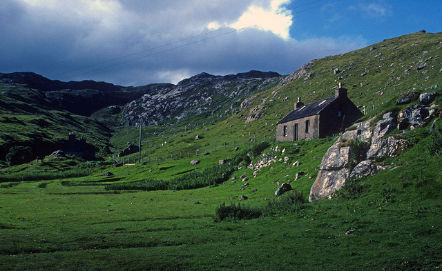
Image: © Julian Paren Taken: Unknown
Today a road and parking space are located below the hostel. But before 1990 there was no road to Rhenigidale. Here is the hostel in 1986 before the road was built and an extra warm welcome would await those who had walked over the hills from Tarbert to stay at the hostel.
Images are licensed for reuse under creativecommons.org/licenses/by-sa/2.0
Image Location
Latitude
57.919589
Longitude
-6.681261