The Tollhouse, Pen-y-pound, Abergavenny
Introduction
The photograph on this page of The Tollhouse, Pen-y-pound, Abergavenny by Jaggery as part of the Geograph project.
The Geograph project started in 2005 with the aim of publishing, organising and preserving representative images for every square kilometre of Great Britain, Ireland and the Isle of Man.

There are currently over 7.5m images from over 14,400 individuals and you can help contribute to the project by visiting https://www.geograph.org.uk
The Tollhouse, Pen-y-pound, Abergavenny
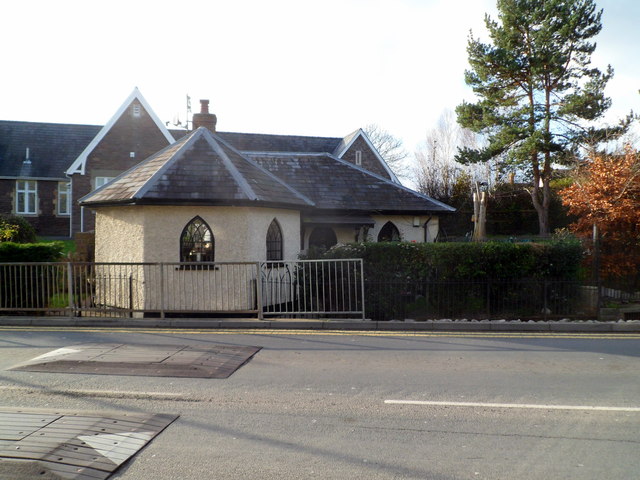
Image: © Jaggery Taken: 7 Dec 2011
Former tollhouse located at the northern end of the road named Pen-y-pound, near the southern end of the old road to Hereford. A plaque on the single-storey five-sided tollhouse records that it was built in 1831, restored (as a dwelling) in 1981.
Images are licensed for reuse under creativecommons.org/licenses/by-sa/2.0
Image Location
Latitude
51.826464
Longitude
-3.022925