Ordnance Survey bolt on St Saviour's Church
Introduction
The photograph on this page of Ordnance Survey bolt on St Saviour's Church by Shantavira as part of the Geograph project.
The Geograph project started in 2005 with the aim of publishing, organising and preserving representative images for every square kilometre of Great Britain, Ireland and the Isle of Man.

There are currently over 7.5m images from over 14,400 individuals and you can help contribute to the project by visiting https://www.geograph.org.uk
Ordnance Survey bolt on St Saviour's Church
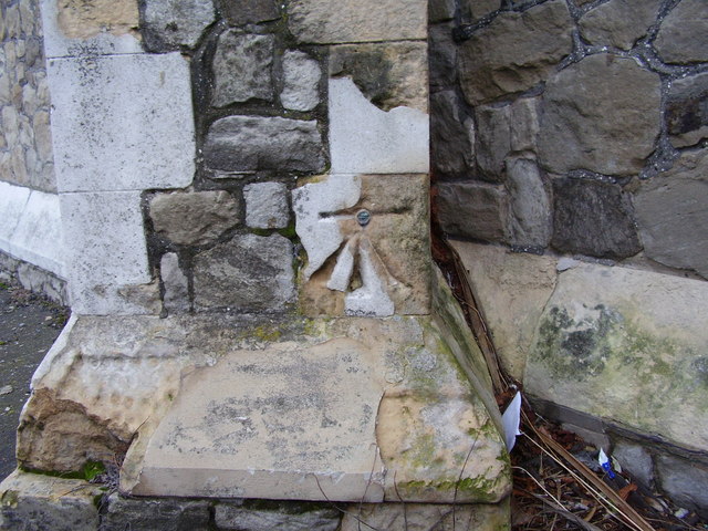
Image: © Shantavira Taken: 23 Dec 2011
Ordnance Survey bolt on north-east face of north-east buttress at St Saviour's Church, Walmer. This bench mark was established in 1851 during the First primary levelling of England & Wales, and was levelled with a height of 23.129 feet above mean sea level (Liverpool datum). It was included on the London to Dover levelling line, Levelling Mark No. 370.
Images are licensed for reuse under creativecommons.org/licenses/by-sa/2.0
Image Location
Latitude
51.213553
Longitude
1.402243