Regents Park Road
Introduction
The photograph on this page of Regents Park Road by Martin Addison as part of the Geograph project.
The Geograph project started in 2005 with the aim of publishing, organising and preserving representative images for every square kilometre of Great Britain, Ireland and the Isle of Man.

There are currently over 7.5m images from over 14,400 individuals and you can help contribute to the project by visiting https://www.geograph.org.uk
Regents Park Road
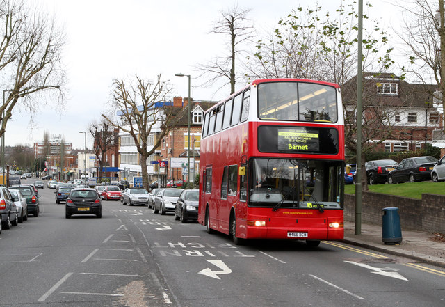
Image: © Martin Addison Taken: 28 Dec 2011
Looking down the hill from the junction with Gravel Hill and East End Road. Leading the procession of traffic is Sullivan Buses VPL119, a Plaxton President bodied Volvo B7TL. The bus is operating a rail replacement service for engineering works on the Northern Line which saw the Barnet and Mill Hill East branches of the network closed from Christmas Day until December 30th for upgrade work. Three routes were operated - this is route A which connected High Barnet with Golders Green station. The other routes were operated by Metroline; Route B followed the Barnet branch connecting with all stations to Camden Town with the exception of West Finchley (low trees prevent double deck operation along Nether Street) and Route C which connected Finchley Central to Mill Hill East.
Images are licensed for reuse under creativecommons.org/licenses/by-sa/2.0
Image Location
Latitude
51.596629
Longitude
-0.198328