The Black Boy, Oving
Introduction
The photograph on this page of The Black Boy, Oving by HelenK as part of the Geograph project.
The Geograph project started in 2005 with the aim of publishing, organising and preserving representative images for every square kilometre of Great Britain, Ireland and the Isle of Man.

There are currently over 7.5m images from over 14,400 individuals and you can help contribute to the project by visiting https://www.geograph.org.uk
The Black Boy, Oving
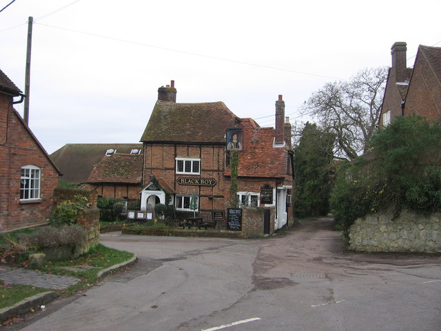
Image: © HelenK Taken: 27 Dec 2011
Oving's pub. "The Black Boy was built circa 1524. The original building is still standing. The front door, bar area with beams, kitchen and living accommodation can still be seen. Various extensions and outbuildings were added in the 20th Century. The Hossle or village pond, situated at the bottom of the pub gardens, was the only source of clean running spring water in the area during drought. Farmers with sheep, cattle or horses would walk their animals from miles away to the spring, which is still as abundant today. It is rumoured that Oliver Cromwell and his New Model Army camped in the pub garden and hossle after sacking nearby Bolebec Castle at Whitchurch. The most common [explanation for the name] is from when Charles II (1660-1685) was in exile his dark complexion earned him the nickname The Black Boy." http://theblackboyoving.co.uk/about/
Images are licensed for reuse under creativecommons.org/licenses/by-sa/2.0
Image Location
Latitude
51.88488
Longitude
-0.865668