Inside the culvert
Introduction
The photograph on this page of Inside the culvert by Antony Dixon as part of the Geograph project.
The Geograph project started in 2005 with the aim of publishing, organising and preserving representative images for every square kilometre of Great Britain, Ireland and the Isle of Man.

There are currently over 7.5m images from over 14,400 individuals and you can help contribute to the project by visiting https://www.geograph.org.uk
Inside the culvert
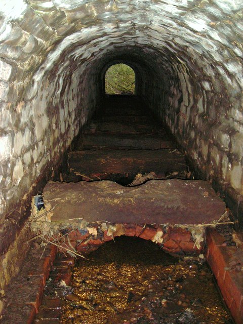
Image: © Antony Dixon Taken: 27 Dec 2011
Closer examination shows that it is not just the arch, but the whole culvert that is stone-built. I imagine that the little stone-capped brick arches date from the time before the embankment was built, and the road crossed Rainworth Water at a much lower level.
Images are licensed for reuse under creativecommons.org/licenses/by-sa/2.0
Image Location
Latitude
53.10097
Longitude
-1.178065