Footbridge 3B Paddington Arm - ramp from Delamere Terrace
Introduction
The photograph on this page of Footbridge 3B Paddington Arm - ramp from Delamere Terrace by David Hawgood as part of the Geograph project.
The Geograph project started in 2005 with the aim of publishing, organising and preserving representative images for every square kilometre of Great Britain, Ireland and the Isle of Man.

There are currently over 7.5m images from over 14,400 individuals and you can help contribute to the project by visiting https://www.geograph.org.uk
Footbridge 3B Paddington Arm - ramp from Delamere Terrace
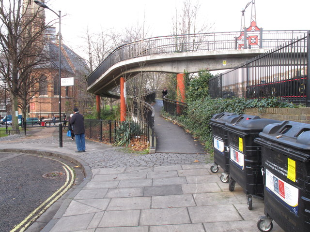
Image: © David Hawgood Taken: 15 Dec 2011
This shows the spiral ramp access to the bridge from the junction of Delamere Terrace and Lord Hills Road. The slope of the ramp is about 6° (1 in 10). There is no direct access to the towpath from the bridge; there is level access between the towpath and Delamere terrace about 30 yards East (behind the camera), with a slope of 5° (1 in 12) on the pavement of Delamere Terrace.
Images are licensed for reuse under creativecommons.org/licenses/by-sa/2.0
Image Location
Latitude
51.522373
Longitude
-0.187999