The gap, Hearsall Lane
Introduction
The photograph on this page of The gap, Hearsall Lane by E Gammie as part of the Geograph project.
The Geograph project started in 2005 with the aim of publishing, organising and preserving representative images for every square kilometre of Great Britain, Ireland and the Isle of Man.

There are currently over 7.5m images from over 14,400 individuals and you can help contribute to the project by visiting https://www.geograph.org.uk
The gap, Hearsall Lane
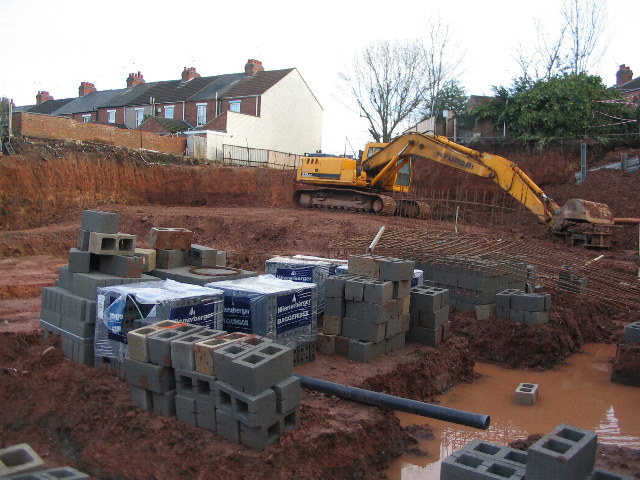
Image: © E Gammie Taken: 24 Dec 2011
For many years this was vacant land hidden by advertising hoardings. Then it was a partially dug bit of land next to hoardings. Now the hoardings are gone, it's a bigger hole and new housing is under construction. The backs of houses in Latham Road are visible in the background. As you can see, it has rained recently and clay doesn't drain well.
Images are licensed for reuse under creativecommons.org/licenses/by-sa/2.0
Image Location


Leaflet Map data © OpenStreetMap
Latitude
52.406727
Longitude
-1.531181