Holywell Hill
Introduction
The photograph on this page of Holywell Hill by Ian Capper as part of the Geograph project.
The Geograph project started in 2005 with the aim of publishing, organising and preserving representative images for every square kilometre of Great Britain, Ireland and the Isle of Man.

There are currently over 7.5m images from over 14,400 individuals and you can help contribute to the project by visiting https://www.geograph.org.uk
Holywell Hill
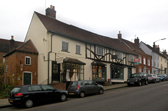
Image: © Ian Capper Taken: 4 Dec 2011
Buildings on the west side of Holywell Hill, all grade II listed. The building in the centre of the photo is no 58-62, 17th century on the left and 16th century on the right - see www.historicengland.org.uk/listing/the-list/list-entry/1173500. To its right (the brick fronted building) is no 56, originally from around 1600 - see www.historicengland.org.uk/listing/the-list/list-entry/1347147. Beyond are nos 52-54 (painted yellow and grey respectively), also originally from around 1600 - see www.historicengland.org.uk/listing/the-list/list-entry/1103101.
Images are licensed for reuse under creativecommons.org/licenses/by-sa/2.0
Image Location
Latitude
51.748945
Longitude
-0.341038