Holywell Hill
Introduction
The photograph on this page of Holywell Hill by Ian Capper as part of the Geograph project.
The Geograph project started in 2005 with the aim of publishing, organising and preserving representative images for every square kilometre of Great Britain, Ireland and the Isle of Man.

There are currently over 7.5m images from over 14,400 individuals and you can help contribute to the project by visiting https://www.geograph.org.uk
Holywell Hill
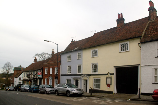
Image: © Ian Capper Taken: 4 Dec 2011
Buildings on the west side of Holywell Hill, all grade II listed. On the right is nos 52-54 (painted yellow and grey respectively, with a carriageway on the right), dating originally from around 1600 - see www.historicengland.org.uk/listing/the-list/list-entry/1103101. On the wall is a World War 1 Street Memorial - for close up see Image Behind the lamppost is no 56, also originally from around 1600 - see www.historicengland.org.uk/listing/the-list/list-entry/1347147. Then no 58-62, 16th century on the right and 17th century on the left - see www.historicengland.org.uk/listing/the-list/list-entry/1173500. The white building protruding in front of the building line is Pickwick House, nos 64-66, originally 15th century - see www.historicengland.org.uk/listing/the-list/list-entry/1103010.
Images are licensed for reuse under creativecommons.org/licenses/by-sa/2.0
Image Location
Latitude
51.749124
Longitude
-0.34093