Holywell Hill
Introduction
The photograph on this page of Holywell Hill by Ian Capper as part of the Geograph project.
The Geograph project started in 2005 with the aim of publishing, organising and preserving representative images for every square kilometre of Great Britain, Ireland and the Isle of Man.

There are currently over 7.5m images from over 14,400 individuals and you can help contribute to the project by visiting https://www.geograph.org.uk
Holywell Hill
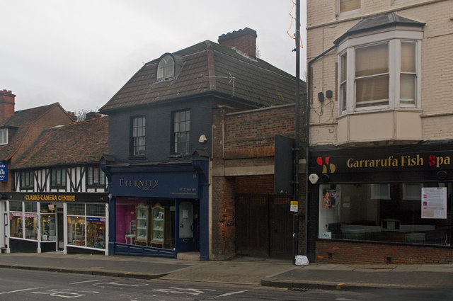
Image: © Ian Capper Taken: 4 Dec 2011
Part of a line of buildings at the top end of Holywell Hill. The gateway between number 10 (on the right) and number 12 leads to a former coach house which served a large Georgian house on High Street. Both these buildings are locally listed. Beyond is number 14-16, with a mock half-timbered front, which is grade II listed, dating originally from the late 16th century - see Image for close up and for listing particulars see www.historicengland.org.uk/listing/the-list/list-entry/1262802.
Images are licensed for reuse under creativecommons.org/licenses/by-sa/2.0
Image Location
Latitude
51.750444
Longitude
-0.340172