Holywell Hill
Introduction
The photograph on this page of Holywell Hill by Ian Capper as part of the Geograph project.
The Geograph project started in 2005 with the aim of publishing, organising and preserving representative images for every square kilometre of Great Britain, Ireland and the Isle of Man.

There are currently over 7.5m images from over 14,400 individuals and you can help contribute to the project by visiting https://www.geograph.org.uk
Holywell Hill
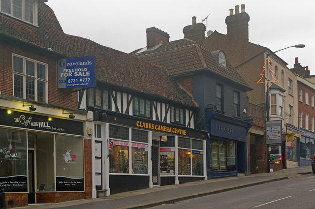
Image: © Ian Capper Taken: 4 Dec 2011
Buildings on the west side of Holywell Hill. In the centre (with a mock half timbered frontage) is nos 14-16, dating originally from the late 16th century, which is grade II listed - for listing particulars see www.historicengland.org.uk/listing/the-list/list-entry/1262802. The remaining buildings are all locally listed.
Images are licensed for reuse under creativecommons.org/licenses/by-sa/2.0
Image Location
Latitude
51.750355
Longitude
-0.340233