My Lady's Road, Belfast
Introduction
The photograph on this page of My Lady's Road, Belfast by Albert Bridge as part of the Geograph project.
The Geograph project started in 2005 with the aim of publishing, organising and preserving representative images for every square kilometre of Great Britain, Ireland and the Isle of Man.

There are currently over 7.5m images from over 14,400 individuals and you can help contribute to the project by visiting https://www.geograph.org.uk
My Lady's Road, Belfast
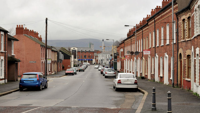
Image: © Albert Bridge Taken: 22 Dec 2011
A street where development seems to have started in the mid/late 1870’s. It runs from the Woodstock Road to the Ravenhill Road (background). The Ravenhill Road did not exist at the time. The area was (and still is) known as “The Lagan Village”. This view is from close to Lawnmount Street.
Images are licensed for reuse under creativecommons.org/licenses/by-sa/2.0
Image Location
Latitude
54.591375
Longitude
-5.908249