The remains of Upper Bank Station, Swansea
Introduction
The photograph on this page of The remains of Upper Bank Station, Swansea by vectorkraft as part of the Geograph project.
The Geograph project started in 2005 with the aim of publishing, organising and preserving representative images for every square kilometre of Great Britain, Ireland and the Isle of Man.

There are currently over 7.5m images from over 14,400 individuals and you can help contribute to the project by visiting https://www.geograph.org.uk
The remains of Upper Bank Station, Swansea
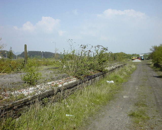
Image: © vectorkraft Taken: 8 May 1998
In this 1998 view, the decaying remains of Upper Bank Station can be seen. Upper Bank was opened in 1871 as part of the Swansea Vale Railway's route to Morriston. It eventually reached Brynamman. The whole line was taken over by the Midland Railway in 1876 and additional through routes were added as a result. Passenger services ceased in 1950 and complete closure took place in the 1960s. By 1985 the only railway here was the section preserved by the SVR Society. In 2007, Swansea Council decided to redevelop the area and by 2010 the preserved railway was itself history, although the society itself lives on.
Images are licensed for reuse under creativecommons.org/licenses/by-sa/2.0
Image Location
Latitude
51.640316
Longitude
-3.92673