The Model Cottages, Mortlake
Introduction
The photograph on this page of The Model Cottages, Mortlake by Stefan Czapski as part of the Geograph project.
The Geograph project started in 2005 with the aim of publishing, organising and preserving representative images for every square kilometre of Great Britain, Ireland and the Isle of Man.

There are currently over 7.5m images from over 14,400 individuals and you can help contribute to the project by visiting https://www.geograph.org.uk
The Model Cottages, Mortlake
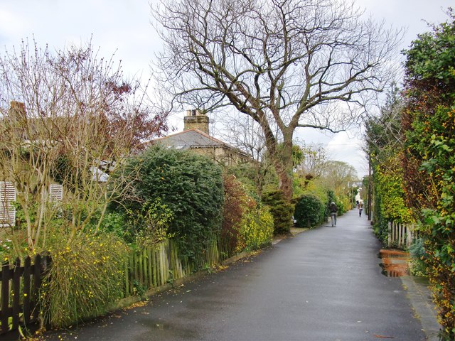
Image: © Stefan Czapski Taken: 16 Dec 2011
For pedestrians, this path provides a north-south link from St Leonard's Road, by way of Waitrose's car park, to Upper Richmond Road West. The Model Cottages line the path on either side. It is clear from the name that they were a product of the 19th century philanthropic movement which set out to improve the 'morals' of the poor by offering them decent dwellings. Overcrowding, in particular, was seen as a source of moral danger. Trees and shrubs obscure the view, but I think you can see that the cottages are by no means tiny - this was no high density development. A resident told me that the Cottages were built for 'the working poor' over a 30-year period from the 1840's. I wonder whether people moved here from the old centre of Mortlake, which was just a few minutes walk away, by the river. Little trace now remains there of the old medieval street plan http://www.geograph.org.uk/photo/2518817 but the picture must have been very different 150 years ago.
Images are licensed for reuse under creativecommons.org/licenses/by-sa/2.0
Image Location
Latitude
51.466134
Longitude
-0.268979