Footbridge 4b Paddington Arm, Wedlake Street access
Introduction
The photograph on this page of Footbridge 4b Paddington Arm, Wedlake Street access by David Hawgood as part of the Geograph project.
The Geograph project started in 2005 with the aim of publishing, organising and preserving representative images for every square kilometre of Great Britain, Ireland and the Isle of Man.

There are currently over 7.5m images from over 14,400 individuals and you can help contribute to the project by visiting https://www.geograph.org.uk
Footbridge 4b Paddington Arm, Wedlake Street access
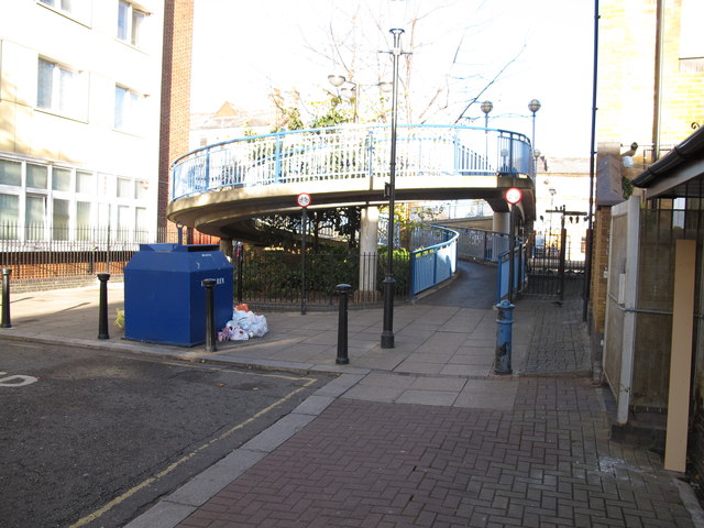
Image: © David Hawgood Taken: 15 Dec 2011
On the right is access to the towpath, level except for a section about 1 metre long at 10.8° (about 1 in 5.5). In the centre is the spiral ramp up onto the footbridge, slope about 5° (1 in 12).
Images are licensed for reuse under creativecommons.org/licenses/by-sa/2.0
Image Location
Latitude
51.525999
Longitude
-0.207461