Paddington Arm - ramp to towpath from Alderson Street
Introduction
The photograph on this page of Paddington Arm - ramp to towpath from Alderson Street by David Hawgood as part of the Geograph project.
The Geograph project started in 2005 with the aim of publishing, organising and preserving representative images for every square kilometre of Great Britain, Ireland and the Isle of Man.

There are currently over 7.5m images from over 14,400 individuals and you can help contribute to the project by visiting https://www.geograph.org.uk
Paddington Arm - ramp to towpath from Alderson Street
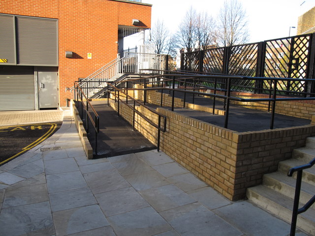
Image: © David Hawgood Taken: 15 Dec 2011
This ramp has been installed this year as part of the development in Alderson Street of Nido student housing. The slope is 3° to 4° (between 1 in 20 and 1 in 15) so it is within the recommended maximum for wheelchair access.
Images are licensed for reuse under creativecommons.org/licenses/by-sa/2.0
Image Location


Leaflet Map data © OpenStreetMap
Latitude
51.526488
Longitude
-0.210036