Holywell Hill
Introduction
The photograph on this page of Holywell Hill by Ian Capper as part of the Geograph project.
The Geograph project started in 2005 with the aim of publishing, organising and preserving representative images for every square kilometre of Great Britain, Ireland and the Isle of Man.

There are currently over 7.5m images from over 14,400 individuals and you can help contribute to the project by visiting https://www.geograph.org.uk
Holywell Hill
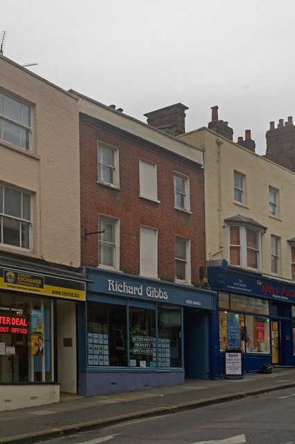
Image: © Ian Capper Taken: 4 Dec 2011
Part of a line of buildings at the top end of Holywell Hill, 18th/19th century replacements of earlier buildings. In the centre is no 6, now housing an estate agency, flanked by nos 8 and 4. All three are locally listed.
Images are licensed for reuse under creativecommons.org/licenses/by-sa/2.0
Image Location
Latitude
51.750596
Longitude
-0.340109