Former Inn, Sopwell Lane
Introduction
The photograph on this page of Former Inn, Sopwell Lane by Ian Capper as part of the Geograph project.
The Geograph project started in 2005 with the aim of publishing, organising and preserving representative images for every square kilometre of Great Britain, Ireland and the Isle of Man.

There are currently over 7.5m images from over 14,400 individuals and you can help contribute to the project by visiting https://www.geograph.org.uk
Former Inn, Sopwell Lane
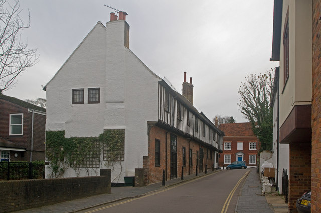
Image: © Ian Capper Taken: 4 Dec 2011
St Albans' best preserved medieval Inn, situated in Sopwell Lane at its junction with Holywell Hill. Prior to the building of the current London Road by Thomas Telford in the late 18th century, Sopwell Lane and Holywell Hill were on the main coaching route into St Albans from London, as a continuation of Old London Road, and this junction turning was a key point on this route. The building here dates from the 16th century, with records showing it in 1556 being called The Crane; later names were The Chequers and The Crown and Anchor. It is now used for housing. Grade II* listed - see www.historicengland.org.uk/listing/the-list/list-entry/1347166 and www.historicengland.org.uk/listing/the-list/list-entry/1103095. See also Image
Images are licensed for reuse under creativecommons.org/licenses/by-sa/2.0
Image Location
Latitude
51.748963
Longitude
-0.340357