RAF Wymeswold
Introduction
The photograph on this page of RAF Wymeswold by Alan Murray-Rust as part of the Geograph project.
The Geograph project started in 2005 with the aim of publishing, organising and preserving representative images for every square kilometre of Great Britain, Ireland and the Isle of Man.

There are currently over 7.5m images from over 14,400 individuals and you can help contribute to the project by visiting https://www.geograph.org.uk
RAF Wymeswold
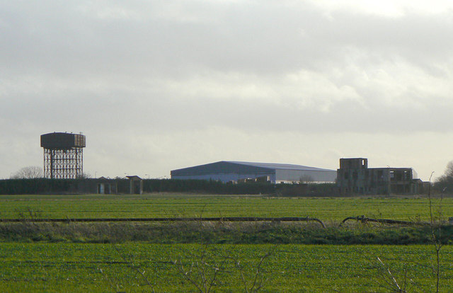
Image: © Alan Murray-Rust Taken: 12 Dec 2011
Seen from Hoton Road with the water tower to the left and the old control tower to the right. The building behind is modern and part of the industrial estate developed on the site.
Images are licensed for reuse under creativecommons.org/licenses/by-sa/2.0
Image Location
Latitude
52.795838
Longitude
-1.12391