Tennant Canal (Wern Fawr Road)
Introduction
The photograph on this page of Tennant Canal (Wern Fawr Road) by vectorkraft as part of the Geograph project.
The Geograph project started in 2005 with the aim of publishing, organising and preserving representative images for every square kilometre of Great Britain, Ireland and the Isle of Man.

There are currently over 7.5m images from over 14,400 individuals and you can help contribute to the project by visiting https://www.geograph.org.uk
Tennant Canal (Wern Fawr Road)
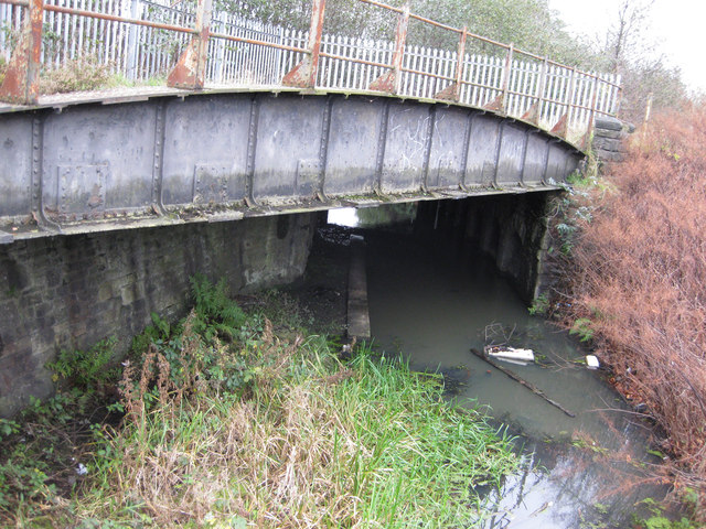
Image: © vectorkraft Taken: 5 Dec 2011
This is a view of the Tennant Canal as seen from the eastern extremity of Wern Fawr Road. The canal led into Swansea Docks until the 1950s (albeit marked as disused on maps); official canal freight operations ceased as early as 1920. The railway viaduct carried freight into Burrows Sidings until the late 1980s. There was a connection with the Marcroft Wagon Works just to the right of this position until the 1990s. The condition of this canal (in 2011) improves as you travel towards Jersey Marine and Neath.
Images are licensed for reuse under creativecommons.org/licenses/by-sa/2.0
Image Location
Latitude
51.622049
Longitude
-3.905442