Tennant Canal (Fabian Way)
Introduction
The photograph on this page of Tennant Canal (Fabian Way) by vectorkraft as part of the Geograph project.
The Geograph project started in 2005 with the aim of publishing, organising and preserving representative images for every square kilometre of Great Britain, Ireland and the Isle of Man.

There are currently over 7.5m images from over 14,400 individuals and you can help contribute to the project by visiting https://www.geograph.org.uk
Tennant Canal (Fabian Way)
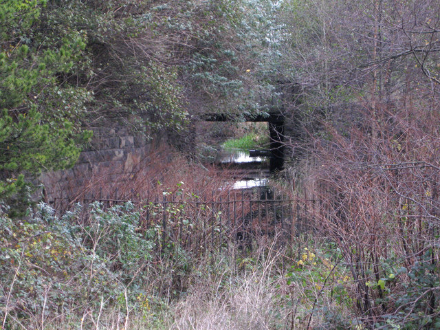
Image: © vectorkraft Taken: 5 Dec 2011
Today, this is the start of the Tennant Canal as seen from Fabian Way. Prior to the 1960s and the building of Fabian Way, the canal continued into Swansea Docks, although this navigation had been marked as disused since the 1920s. Completed in 1824, the canal originally continued from this position in the photograph towards the eastern end of the Prince of Wales Dock - this being the original ‘Tennants Wharf’. A diversion was created c1905 to take the canal towards the newly built Kings Dock. By 1920, all freight operations on the canal had ceased and the lock into the Kings Dock had been blocked off. Despite this, the basic canal remained in fairly good condition until the late 1930s. After this period, the canal became less navigable and is from this point marked as 'Tennant Canal (disused)' on maps. Substantial decay of the route followed. By the 1950s the Kings Dock connection was filled in and by the 1960s the canal had receded as far as this position shown in the photograph above due to road construction. The condition of this canal (in 2011) improves as you travel towards Jersey Marine and Neath.
Images are licensed for reuse under creativecommons.org/licenses/by-sa/2.0
Image Location
Latitude
51.62186
Longitude
-3.906012