Fabian Way - Wern Fawr Road level crossing
Introduction
The photograph on this page of Fabian Way - Wern Fawr Road level crossing by vectorkraft as part of the Geograph project.
The Geograph project started in 2005 with the aim of publishing, organising and preserving representative images for every square kilometre of Great Britain, Ireland and the Isle of Man.

There are currently over 7.5m images from over 14,400 individuals and you can help contribute to the project by visiting https://www.geograph.org.uk
Fabian Way - Wern Fawr Road level crossing
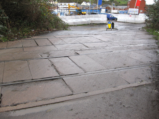
Image: © vectorkraft Taken: 5 Dec 2011
These railway lines originally formed part of the Vale of Neath Railway dating back to the 19th Century. In the early 1980s, the access road shown was laid as a convenient access route to the former railway wagon repair works sited on Wern Fawr Road (Marcroft Wagon Works). The building of this road necessitated a new level crossing which had not existed previously. This road continues to be used by lorries heading for the Tir John landfill site. The lines were thought to be last used in the late 1980s (or very early 1990s) and originally led to Burrows Sidings to the east. A signal cabin was located just to the left of this view up until the 1950s. A 1917 OS Map shows there was an additional signal cabin just to the right of this view, although this had gone by the 1940s. This access road is unnamed, but runs from Fabian Way to Wern Fawr Road. A new estate of houses occupies the former wagon works.
Images are licensed for reuse under creativecommons.org/licenses/by-sa/2.0
Image Location
Latitude
51.62212
Longitude
-3.9066