34 Seymour Road
Introduction
The photograph on this page of 34 Seymour Road by Alan Murray-Rust as part of the Geograph project.
The Geograph project started in 2005 with the aim of publishing, organising and preserving representative images for every square kilometre of Great Britain, Ireland and the Isle of Man.

There are currently over 7.5m images from over 14,400 individuals and you can help contribute to the project by visiting https://www.geograph.org.uk
34 Seymour Road
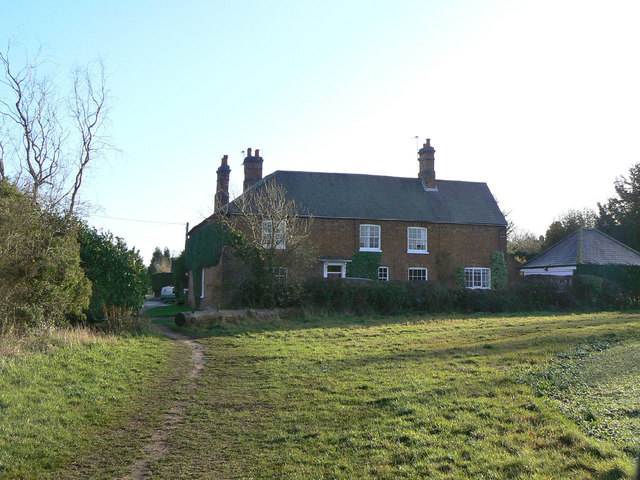
Image: © Alan Murray-Rust Taken: 12 Dec 2011
This and its neighbour at 32 Seymour Road were originally a single dwelling, of which 34 was the original part from the late 18th century. The location of this house on the edge of the present village results from the fact that the footpath follows the line of the old bridle road from Burton to Loughborough, then the main road through the village, which was diverted when Prestwold Park was created. Listed Grade II.
Images are licensed for reuse under creativecommons.org/licenses/by-sa/2.0
Image Location


Leaflet Map data © OpenStreetMap
Latitude
52.786086
Longitude
-1.130185