Prestwold Hall, east fa?ade and gardens
Introduction
The photograph on this page of Prestwold Hall, east fa?ade and gardens by Alan Murray-Rust as part of the Geograph project.
The Geograph project started in 2005 with the aim of publishing, organising and preserving representative images for every square kilometre of Great Britain, Ireland and the Isle of Man.

There are currently over 7.5m images from over 14,400 individuals and you can help contribute to the project by visiting https://www.geograph.org.uk
Prestwold Hall, east fa?ade and gardens
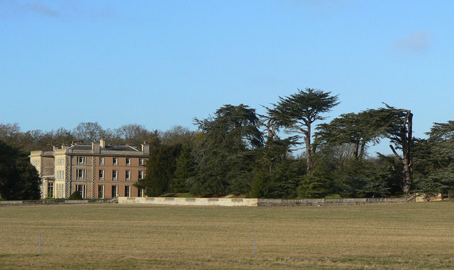
Image: © Alan Murray-Rust Taken: 12 Dec 2011
Just one bay of the east front retains the ashlar of the main front, the remainder being of painted brickwork. The eastern part of the gardens forms a small arboretum; some of the trees are beginning to show signs of age; they were apparently well established by 1780. Hall is listed Grade I, gardens Grade II.
Images are licensed for reuse under creativecommons.org/licenses/by-sa/2.0
Image Location


Leaflet Map data © OpenStreetMap
Latitude
52.787703
Longitude
-1.14246