Chadkirk Farm
Introduction
The photograph on this page of Chadkirk Farm by David Dixon as part of the Geograph project.
The Geograph project started in 2005 with the aim of publishing, organising and preserving representative images for every square kilometre of Great Britain, Ireland and the Isle of Man.

There are currently over 7.5m images from over 14,400 individuals and you can help contribute to the project by visiting https://www.geograph.org.uk
Chadkirk Farm
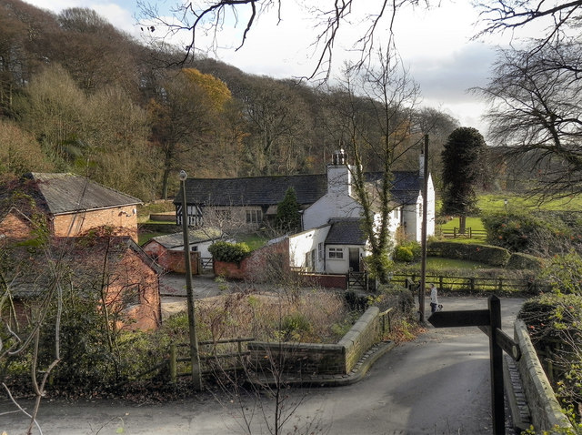
Image: © David Dixon Taken: 13 Dec 2011
Chadkirk Country Estate occupies approx 60 acres and is comprised of low lying farm land and Ancient woodland. These Ancient woodlands are designated as Sites of Biological Importance due to the rich flora & fauna associated with these old woodlands. The entire Estate has been designated as an LNR, (Local Nature Reserve). http://www.chadkirkchapel.org.uk/about_chadkirk.asp (Chadkirk Chapel & Country Estate). The farmland is flat and fertile; the soils having been laid down over a long period of time by flood waters of the River Goyt. This deep fertile soil contrasts sharply with the shallow infertile soils which have developed on the shales and sandstones of the surrounding wooded slopes. The land has probably been in cultivation here since Saxon times (5th century), and maybe earlier as Ancient Britons (Celts) are likely to have farmed the land before the Roman invasion of Britain. The exact age of the present farm is not known, but the west wing of the farmhouse dates from seventeenth century or earlier whilst the south wing was built (or altered) in 1748. Today, the farm is owned by Stockport MBC and is run by a tenant farmer who keeps mixed livestock and grows crops for animal fodder. (adapted from a nearby information board)
Images are licensed for reuse under creativecommons.org/licenses/by-sa/2.0
Image Location
Latitude
53.409028
Longitude
-2.092174