Pont-y-Pentre datestone with benchmark, Llanfairfechan
Introduction
The photograph on this page of Pont-y-Pentre datestone with benchmark, Llanfairfechan by Meirion as part of the Geograph project.
The Geograph project started in 2005 with the aim of publishing, organising and preserving representative images for every square kilometre of Great Britain, Ireland and the Isle of Man.

There are currently over 7.5m images from over 14,400 individuals and you can help contribute to the project by visiting https://www.geograph.org.uk
Pont-y-Pentre datestone with benchmark, Llanfairfechan
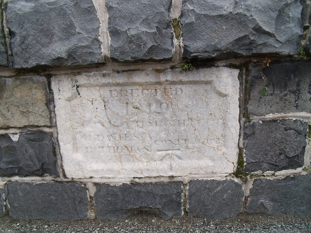
Image: © Meirion Taken: 1 Dec 2011
A datestone on Pont-y-Pentre bridge in Llanfairfechan, it looks like the date in 1819? Also on the datestone is a cut mark benchmark which is shown in the current Ordnance Survey database at a height of 43.993m above the Newlyn datum.
Images are licensed for reuse under creativecommons.org/licenses/by-sa/2.0
Image Location
Latitude
53.252217
Longitude
-3.974423