Church Road, Holywood (1)
Introduction
The photograph on this page of Church Road, Holywood (1) by Albert Bridge as part of the Geograph project.
The Geograph project started in 2005 with the aim of publishing, organising and preserving representative images for every square kilometre of Great Britain, Ireland and the Isle of Man.

There are currently over 7.5m images from over 14,400 individuals and you can help contribute to the project by visiting https://www.geograph.org.uk
Church Road, Holywood (1)
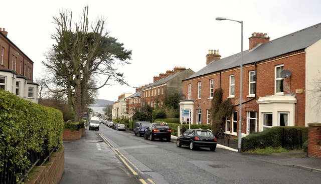
Image: © Albert Bridge Taken: 10 Dec 2011
A residential road, with views to the Co Antrim side of Belfast Lough (background), running uphill to the south east of the town centre. Lined by many Victorian terraces - some of which are listed. Riverside Terrace Image (right) is not listed but is described there as “A block of two semi-detached two-storey late-nineteenth century houses, located on Church Road near Holywood town centre. Both have been altered over the years, with replacement windows and entrance doors to front.”.
Images are licensed for reuse under creativecommons.org/licenses/by-sa/2.0
Image Location
Latitude
54.639846
Longitude
-5.828925