The Cock
Introduction
The photograph on this page of The Cock by Ian Capper as part of the Geograph project.
The Geograph project started in 2005 with the aim of publishing, organising and preserving representative images for every square kilometre of Great Britain, Ireland and the Isle of Man.

There are currently over 7.5m images from over 14,400 individuals and you can help contribute to the project by visiting https://www.geograph.org.uk
The Cock
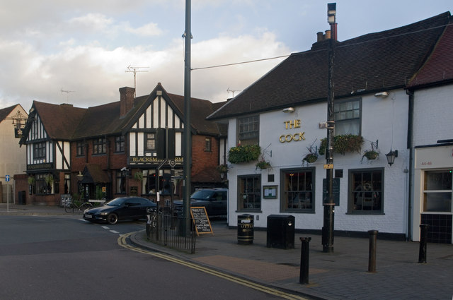
Image: © Ian Capper Taken: 3 Dec 2011
A pub with 16th/early 17th century origins at the junction of Hatfield Road (formerly called Cock Lane) and St Peters Street. Grade II listed - for listing particulars see www.historicengland.org.uk/listing/the-list/list-entry/1251280. Beyond, on the other side of Hatfield Road, is the Blacksmiths Arms - Image
Images are licensed for reuse under creativecommons.org/licenses/by-sa/2.0
Image Location
Latitude
51.754513
Longitude
-0.336097