Nos 2-6 High Street, Holywood
Introduction
The photograph on this page of Nos 2-6 High Street, Holywood by Albert Bridge as part of the Geograph project.
The Geograph project started in 2005 with the aim of publishing, organising and preserving representative images for every square kilometre of Great Britain, Ireland and the Isle of Man.

There are currently over 7.5m images from over 14,400 individuals and you can help contribute to the project by visiting https://www.geograph.org.uk
Nos 2-6 High Street, Holywood
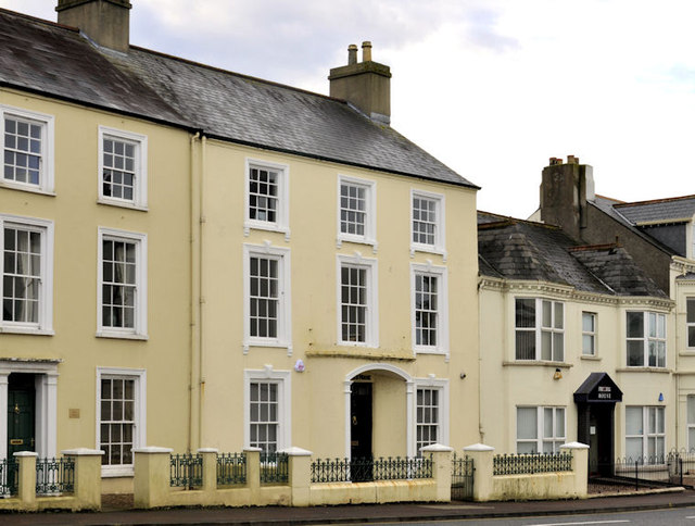
Image: © Albert Bridge Taken: 10 Dec 2011
Three properties at the Bangor end of High Street (Bangor Road on the Google map). No 2 (left) is not listed but is mentioned on the list as “An attached corner-sited L-shaped late-nineteenth century house, located at the junction of High Street and Victoria Road, Holywood . . . . . The house is unremarkable within the context of the area, and is not considered to be of special interest.” No 4 is listed as HB23/20/005 without a description. No 6 - Rollo House (right) is listed as HB23/20/006 without a description.
Images are licensed for reuse under creativecommons.org/licenses/by-sa/2.0
Image Location
Latitude
54.642866
Longitude
-5.832017