Low Level Station Redevelopment
Introduction
The photograph on this page of Low Level Station Redevelopment by John M as part of the Geograph project.
The Geograph project started in 2005 with the aim of publishing, organising and preserving representative images for every square kilometre of Great Britain, Ireland and the Isle of Man.

There are currently over 7.5m images from over 14,400 individuals and you can help contribute to the project by visiting https://www.geograph.org.uk
Low Level Station Redevelopment
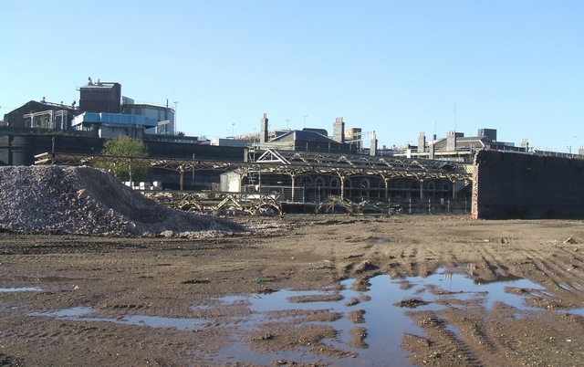
Image: © John M Taken: 4 Nov 2006
The structure of the canopies are exposed awaiting renovation. Wolverhampton (High Level) Station is immediately behind and above the old disused GWR station.
Images are licensed for reuse under creativecommons.org/licenses/by-sa/2.0
Image Location
Latitude
52.587845
Longitude
-2.118038