A walk through Twyford Wood: No 9
Introduction
The photograph on this page of A walk through Twyford Wood: No 9 by Kate Jewell as part of the Geograph project.
The Geograph project started in 2005 with the aim of publishing, organising and preserving representative images for every square kilometre of Great Britain, Ireland and the Isle of Man.

There are currently over 7.5m images from over 14,400 individuals and you can help contribute to the project by visiting https://www.geograph.org.uk
A walk through Twyford Wood: No 9
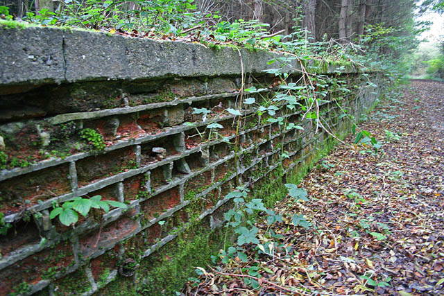
Image: © Kate Jewell Taken: 3 Nov 2006
Twyford Wood is an ancient forest which was requisitioned by the RAF in the early 1940s for the construction of North Witham airfield. Decommissioned at the end of the Second World War the site was kept under "care and maintenance" until it was sold back to the Forestry Commission in the early 1960s. There has been an extensive replanting of the site since then and it is open to the public for walking, riding and cycling. The remains of the airfield infrastructure are obvious through the wood, the concrete runways and roads being the most obvious. This photograph shows remnants of a brick wall, part of the buildings on the perimeter of the airfield. These walls are frequent features of this part of the wood, probably something to do with the bomb stores. See http://raf-lincolnshire.info/northwitham/northwitham.htm for detailed history of the site. To follow the walk pick up the images in order. It starts in this square, (no 1), continues into Image and moves into Image before returning to this square and the car park.
Images are licensed for reuse under creativecommons.org/licenses/by-sa/2.0
Image Location
Latitude
52.799905
Longitude
-0.593262