Benchmark on Burden's Ball Bridge
Introduction
The photograph on this page of Benchmark on Burden's Ball Bridge by Jonathan Kington as part of the Geograph project.
The Geograph project started in 2005 with the aim of publishing, organising and preserving representative images for every square kilometre of Great Britain, Ireland and the Isle of Man.

There are currently over 7.5m images from over 14,400 individuals and you can help contribute to the project by visiting https://www.geograph.org.uk
Benchmark on Burden's Ball Bridge
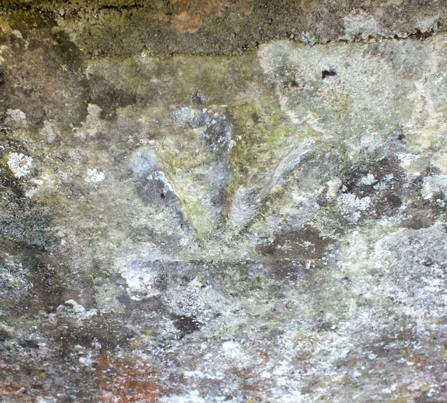
Image: © Jonathan Kington Taken: 5 Dec 2011
This benchmark is located on the outside of the north-west buttress of Image and is inverted. The mark was originally a bolt mark that was used during the First Primary Levelling of England & Wales in 1848-1849 (see http://www.bench-marks.org.uk/bm29813 ). It is thought that the bolt was replaced by a cut mark at some time between 1880 and 1901 which would have been when the bridge was widened at the end of the 19th century, further work was carried out in the 1960's so it is possible that the stone holding the cut mark was replaced the wrong way up and back to front at this time. For more information see http://www.bench-marks.org.uk/bm40430 .
Images are licensed for reuse under creativecommons.org/licenses/by-sa/2.0
Image Location
Latitude
51.082915
Longitude
-1.8599