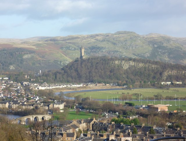
The Abbey Craig from Stirling Castle
Introduction
The photograph on this page of The Abbey Craig from Stirling Castle by kim traynor as part of the Geograph project.
The Geograph project started in 2005 with the aim of publishing, organising and preserving representative images for every square kilometre of Great Britain, Ireland and the Isle of Man.
There are currently over 7.5m images from over 14,400 individuals and you can help contribute to the project by visiting https://www.geograph.org.uk

Image: © kim traynor Taken: 27 Nov 2011
A view from the esplanade of Stirling Castle looking eastwards towards the Abbey Craig where the Wallace Monument, built in 1861, marks the spot where William Wallace and Andrew Moray are said to have lain in wait before the battle of Stirling Bridge against an English army in 1297. The wooden bridge which featured in the battle stood just upstream from the mediaeval stone bridge (c.1500) visible in the lower left-hand corner of the photograph. In 1746, one of the arches of the stone bridge was deliberately blown up to prevent the Jacobite army crossing the river to reach the town and the castle.

