The Old Sub-Deanery and Paley Flats
Introduction
The photograph on this page of The Old Sub-Deanery and Paley Flats by Jo and Steve Turner as part of the Geograph project.
The Geograph project started in 2005 with the aim of publishing, organising and preserving representative images for every square kilometre of Great Britain, Ireland and the Isle of Man.

There are currently over 7.5m images from over 14,400 individuals and you can help contribute to the project by visiting https://www.geograph.org.uk
The Old Sub-Deanery and Paley Flats
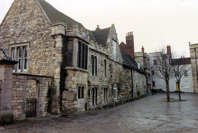
Image: © Jo and Steve Turner Taken: 12 Jan 1991
Grade 1 listed building No.17 Minster Yard. 13th & 14th century with 15th century additions. Sacked in 1644 and restored 1671-94 and 1704-32. Internal alterations around 1813, by William Fowler.
Images are licensed for reuse under creativecommons.org/licenses/by-sa/2.0
Image Location
Latitude
53.234058
Longitude
-0.537628