Halton Tower from the churchyard
Introduction
The photograph on this page of Halton Tower from the churchyard by Andrew Curtis as part of the Geograph project.
The Geograph project started in 2005 with the aim of publishing, organising and preserving representative images for every square kilometre of Great Britain, Ireland and the Isle of Man.

There are currently over 7.5m images from over 14,400 individuals and you can help contribute to the project by visiting https://www.geograph.org.uk
Halton Tower from the churchyard
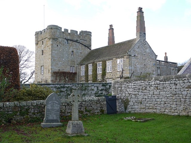
Image: © Andrew Curtis Taken: 25 Nov 2011
A converted C14th tower (Halton Castle) attached to a late C17th house. The four-storey tower was built with Roman stones taken from the fort on Hadrian's Wall to the north. http://www.pastscape.org.uk/hob.aspx?hob_id=18213
Images are licensed for reuse under creativecommons.org/licenses/by-sa/2.0
Image Location


Leaflet Map data © OpenStreetMap
Latitude
55.005126
Longitude
-2.006067