Flush Bracket S7178
Introduction
The photograph on this page of Flush Bracket S7178 by Shantavira as part of the Geograph project.
The Geograph project started in 2005 with the aim of publishing, organising and preserving representative images for every square kilometre of Great Britain, Ireland and the Isle of Man.

There are currently over 7.5m images from over 14,400 individuals and you can help contribute to the project by visiting https://www.geograph.org.uk
Flush Bracket S7178
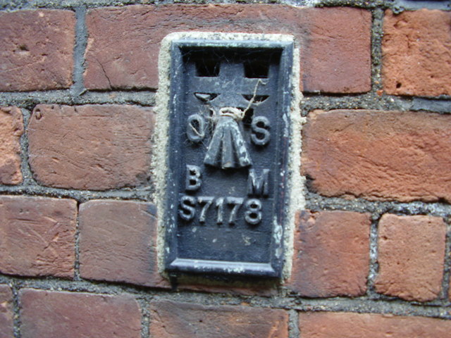
Image: © Shantavira Taken: 15 Apr 2009
Ordnance Survey flush bracket on Skinners' Company's School for Girls, not visible from the road but halfway down some steps leading to the basement. This flush bracket was established during the Third geodetic levelling of England & Wales (1950-68). It was included on the Croydon to Buntingford levelling line and verified by the OS in 1974 with a height of 31.908m above sea level (Newlyn datum).
Images are licensed for reuse under creativecommons.org/licenses/by-sa/2.0
Image Location
Latitude
51.572519
Longitude
-0.073156