Footpath and cycle route near Ystradmeurig, Ceredigion
Introduction
The photograph on this page of Footpath and cycle route near Ystradmeurig, Ceredigion by Roger D Kidd as part of the Geograph project.
The Geograph project started in 2005 with the aim of publishing, organising and preserving representative images for every square kilometre of Great Britain, Ireland and the Isle of Man.

There are currently over 7.5m images from over 14,400 individuals and you can help contribute to the project by visiting https://www.geograph.org.uk
Footpath and cycle route near Ystradmeurig, Ceredigion
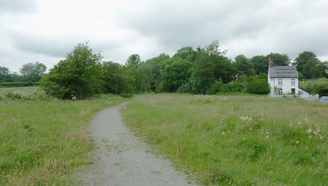
Image: © Roger D Kidd Taken: 10 Jul 2011
Looking towards Aberystwyth, this is the course of a dismantled railway line. Here, having crossed part of the Cors Caron bog, it swings westwards past the village of Ystradmeurig. This image was taken from near the site of the former Strata Florida Station. Station House is on the right. There is an image of the station in 1904 here: http://www.hanesybont.org.uk/corscaron/yrailway.htm The Manchester and Milford Railway (which went to neither place) closed in 1965, but the track bed adjacent to and across part of the Cors Caron nature reserve is now used as a public footpath and the National Cycle Route No 82 (Fishguard to Machynlleth via Lampeter and Aberystwyth). Wikipedia states that this was the Carmarthen to Aberystwyth Line, a standard gauge branch line of the Great Western Railway in Wales. As a result of floods and the Beeching Axe, the line closed throughout to passengers from 1965, and to freight from Pont Llanio creamery near Tregaron to Aberaeron Junction near Lampeter in 1970.
Images are licensed for reuse under creativecommons.org/licenses/by-sa/2.0
Image Location
Latitude
52.287629
Longitude
-3.89177