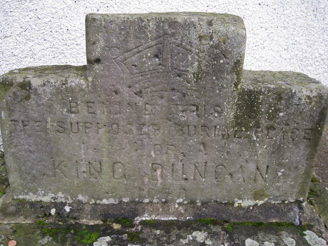
King Duncan buried here?
Introduction
The photograph on this page of King Duncan buried here? by Richard Dorrell as part of the Geograph project.
The Geograph project started in 2005 with the aim of publishing, organising and preserving representative images for every square kilometre of Great Britain, Ireland and the Isle of Man.
There are currently over 7.5m images from over 14,400 individuals and you can help contribute to the project by visiting https://www.geograph.org.uk

Image: © Richard Dorrell Taken: 23 Nov 2011
This carved stone stands on the corner of Culcabock Avenue, in front of an area of ground formerly known as King Duncan's Hollow. The inscription reads: 'Behind this is the supposed burial place of King Duncan 1140.' However, an archaeological evaluation was undertaken in February 2002 in advance of the refurbishment and extension of an existing service station. The area known as King Duncan's Hollow is marked on the 1st edition OS map (1868) as the 'Supposed site of King Duncan's Grave'. There is no evidence for the source of this association and no archaeologically significant deposits were identified in the course of the evaluation. (Information from The Royal Commission on the Ancient and Historical Monuments of Scotland). Wider view: Image

