Car park resurfacing
Introduction
The photograph on this page of Car park resurfacing by John Goldsmith as part of the Geograph project.
The Geograph project started in 2005 with the aim of publishing, organising and preserving representative images for every square kilometre of Great Britain, Ireland and the Isle of Man.

There are currently over 7.5m images from over 14,400 individuals and you can help contribute to the project by visiting https://www.geograph.org.uk
Car park resurfacing
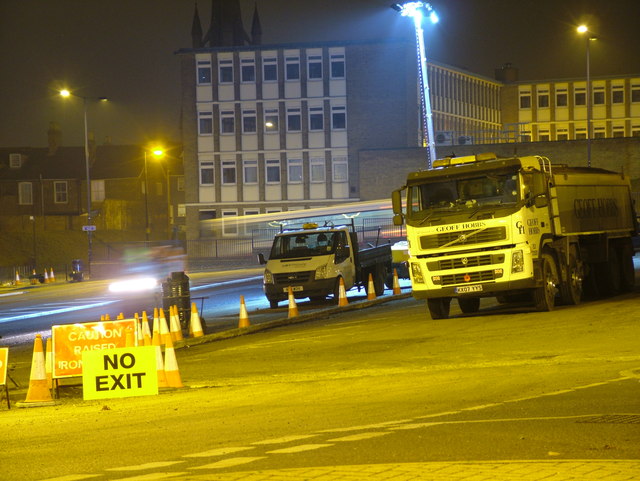
Image: © John Goldsmith Taken: 16 Nov 2011
This car park resurfacing seemed to be very well organised and sequenced. A part was barred to access, new access and exit routes defined, a new surface laid and smoothed, new white lines added, and then the operation moved on to the next section. The transitions to old tarmac were blended very smoothly, and the drains were cleared. Triton House in the background houses the income tax offices, the Job Centre, the driving test centre, and some of the local courts. Between the car park and the building is the exit lane from the bus station, and here we see the blur of a bus on its way out. The blur of light above the NO EXIT sign is the road roller on the move. Triton House is in St. Andrews Street, and behind it we can see the spire of St. John's church, which is in St. John's Street.
Images are licensed for reuse under creativecommons.org/licenses/by-sa/2.0
Image Location
Latitude
52.248537
Longitude
0.709764