View from the top of Pine Tree Way, Barnfields
Introduction
The photograph on this page of View from the top of Pine Tree Way, Barnfields by Penny Mayes as part of the Geograph project.
The Geograph project started in 2005 with the aim of publishing, organising and preserving representative images for every square kilometre of Great Britain, Ireland and the Isle of Man.

There are currently over 7.5m images from over 14,400 individuals and you can help contribute to the project by visiting https://www.geograph.org.uk
View from the top of Pine Tree Way, Barnfields
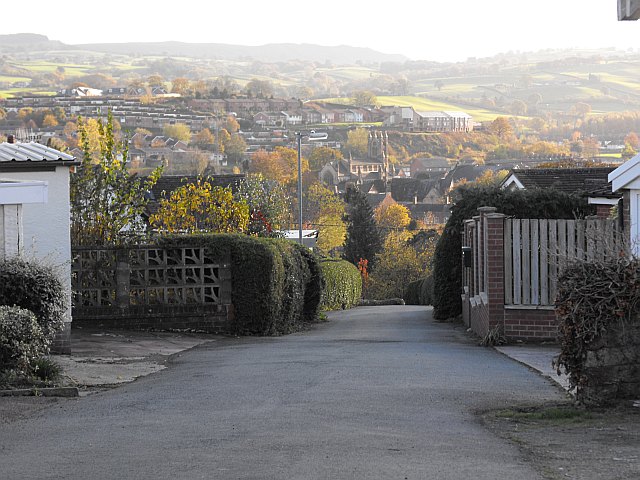
Image: © Penny Mayes Taken: 3 Nov 2011
Pine Tree Way is one of two private roads in the old Barnfields estate. Most houses here were built in the 1950s. The redundant church of St David Image http://www.geograph.org.uk/photo/1424901 with its tower is visible in the centre of the photo. Beyond, above and to the right of the tower, is the Bethshan Care Home http://www.bethshan.org.uk/ on Heol Treowen. The housing estate across the hillside to the left is Treowen.
Images are licensed for reuse under creativecommons.org/licenses/by-sa/2.0
Image Location
Latitude
52.518793
Longitude
-3.3107