
Old farm buildings at Westbrook Farm
Introduction
The photograph on this page of Old farm buildings at Westbrook Farm by Stefan Czapski as part of the Geograph project.
The Geograph project started in 2005 with the aim of publishing, organising and preserving representative images for every square kilometre of Great Britain, Ireland and the Isle of Man.

There are currently over 7.5m images from over 14,400 individuals and you can help contribute to the project by visiting https://www.geograph.org.uk
Old farm buildings at Westbrook Farm
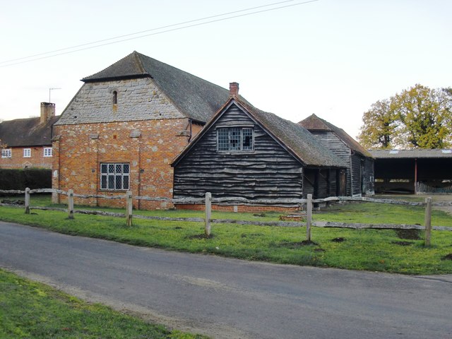
Image: © Stefan Czapski Taken: 19 Nov 2011
Taken in the fading light of a November afternoon. The buildings seen here stand on the W side of a large farmyard, which extends well beyond the frame of the picture, to the right. The low, weather-boarded building nearest the camera looks to me as if it was once a cart-shed, with four bays. The taller, brick-built building on the left has some puzzling features - I mean to have a closer look at it in good daylight, and when I'm in less of a hurry.
Images are licensed for reuse under creativecommons.org/licenses/by-sa/2.0
Image Location

Latitude
51.184297
Longitude
-0.714825