Former Tabor church, Maesteg
Introduction
The photograph on this page of Former Tabor church, Maesteg by Jaggery as part of the Geograph project.
The Geograph project started in 2005 with the aim of publishing, organising and preserving representative images for every square kilometre of Great Britain, Ireland and the Isle of Man.

There are currently over 7.5m images from over 14,400 individuals and you can help contribute to the project by visiting https://www.geograph.org.uk
Former Tabor church, Maesteg
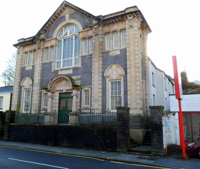
Image: © Jaggery Taken: 17 Nov 2011
Viewed across Commercial Street. This was formerly Tabor Calvinistic Methodist Church, built in 1907. The facade has been retained, but the rest of the building has been converted to flats. Some windows of the flats can be seen between the facade and the red sign.
Images are licensed for reuse under creativecommons.org/licenses/by-sa/2.0
Image Location
Latitude
51.606137
Longitude
-3.65624