St Keyne Station
Introduction
The photograph on this page of St Keyne Station by Tony Atkin as part of the Geograph project.
The Geograph project started in 2005 with the aim of publishing, organising and preserving representative images for every square kilometre of Great Britain, Ireland and the Isle of Man.

There are currently over 7.5m images from over 14,400 individuals and you can help contribute to the project by visiting https://www.geograph.org.uk
St Keyne Station
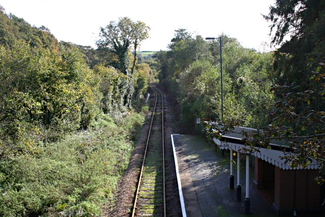
Image: © Tony Atkin Taken: 29 Oct 2006
This photograph was taken in October 2006 and I am posting it as a contrast to this: Image taken in April 2000. What has changed? If you get off the train at this halt intending to walk to St Keyne village, you might like to know that it is a 1.2km walk horizontally and 110 metres vertically, up hill all the way.
Images are licensed for reuse under creativecommons.org/licenses/by-sa/2.0
Image Location


Leaflet Map data © OpenStreetMap
Latitude
50.421852
Longitude
-4.463486