Whinney Hill, Craigantlet (3)
Introduction
The photograph on this page of Whinney Hill, Craigantlet (3) by Albert Bridge as part of the Geograph project.
The Geograph project started in 2005 with the aim of publishing, organising and preserving representative images for every square kilometre of Great Britain, Ireland and the Isle of Man.

There are currently over 7.5m images from over 14,400 individuals and you can help contribute to the project by visiting https://www.geograph.org.uk
Whinney Hill, Craigantlet (3)
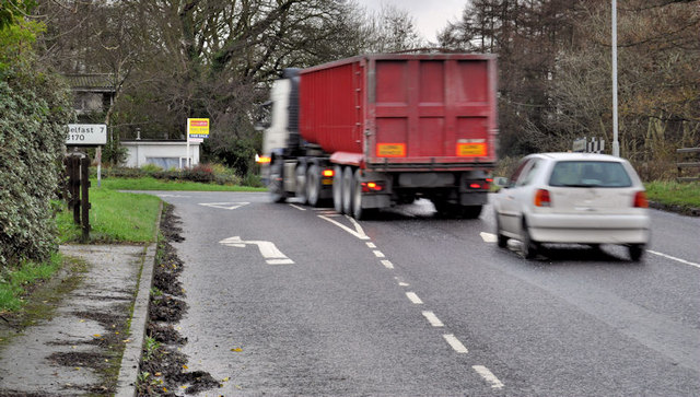
Image: © Albert Bridge Taken: 18 Nov 2011
Whinney Hill Image at the Ballymiscaw Road. This shows one of the reasons for the proposed improvements. The left turn (to Belfast) lane is quite short and narrow and not really suitable for lorries. Drivers, turning right towards the crossroads, can find their view blocked by oncoming traffic turning left.
Images are licensed for reuse under creativecommons.org/licenses/by-sa/2.0
Image Location
Latitude
54.621204
Longitude
-5.777117